


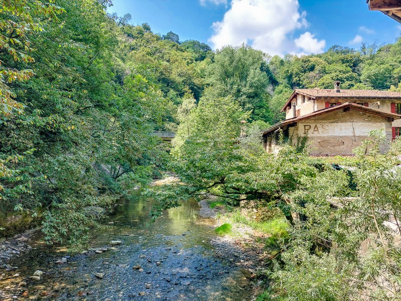
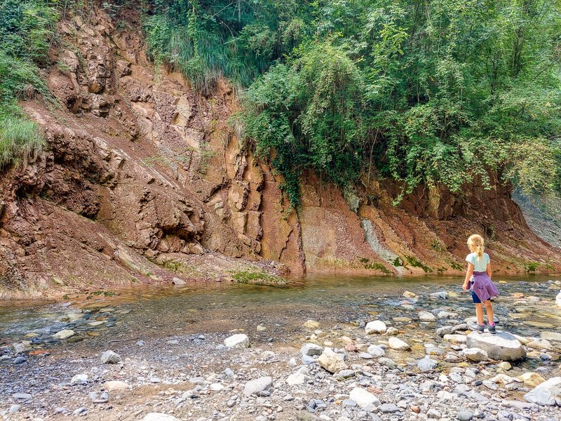
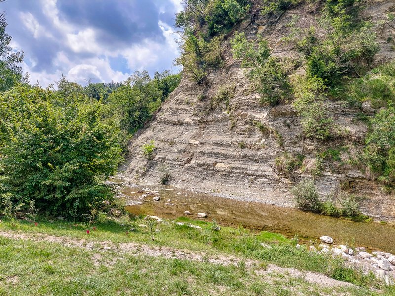
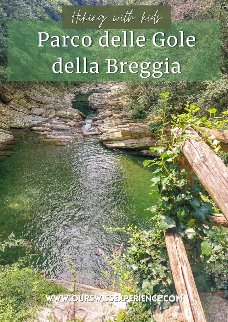
The Breggia River Gorge Nature Park in the southern part of the Muggio Valley in the Italian-speaking canton of Ticino is Switzerland’s first geopark. That’s why this five-kilometre-long route is like a journey through time. Not only can you see extraordinary geological formations dating back 200 million years, but you can also delve into the area’s industrial past – along the river, you will come across an abandoned brewery and a former cement factory.
Route
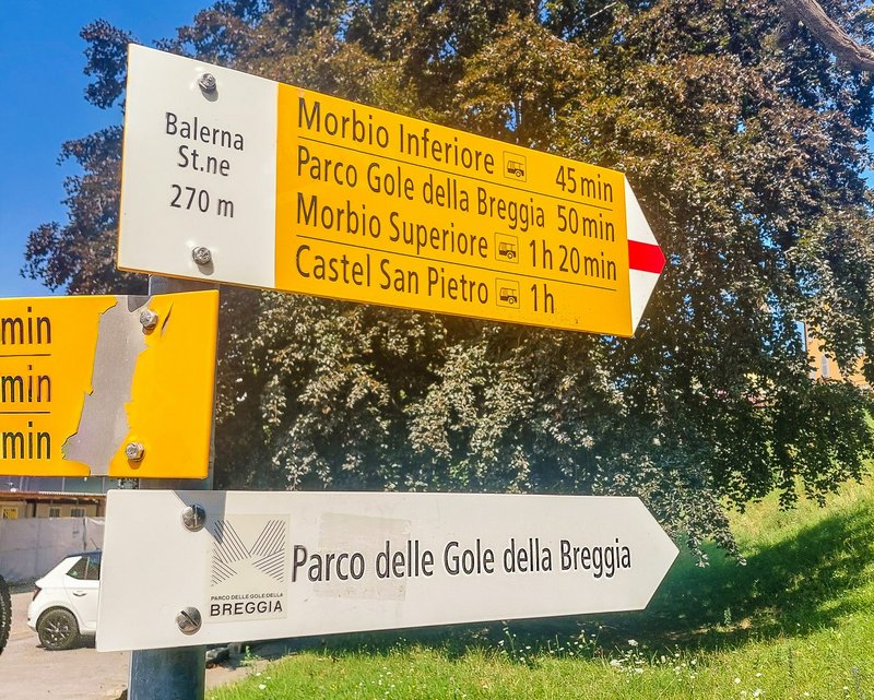
The route starts in the village of Balerna, about 25 km south of Lugano. A direct train service from Lugano – line S10 runs every half an hour, always at .06 and .36. The route ends in the village of Castel San Pietro. From the Castel S. Pietro, Posta bus stop, you will be taken by bus line 513 to Mendrisio. From there, you can return to Balerna or continue to Lugano. You can find a detailed route profile on the website, in the Tourenplaner app, or in my hiking guide, Die 44 schönsten Familien Wanderungen.
Start of the route: Balerna
Balerna was probably a center of settlement already in prehistoric times. Still, it gained some importance only with the pre-Alpine area’s conquest by the Romans. In the 5th century, with the spread of Christianity, Balerna became a parish. In the following century, it was occupied by the Lombards and then came under the control of the Bishop of Como. From 1521, the municipality permanently became part of the property of the Swiss cantons, and after the creation of the canton of Ticino (1803), Balerna became directly Swiss property.*
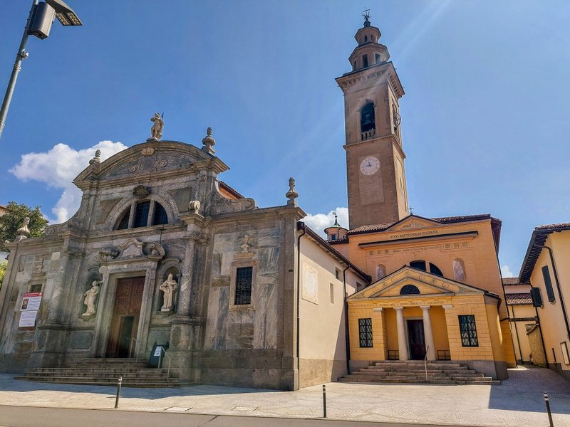
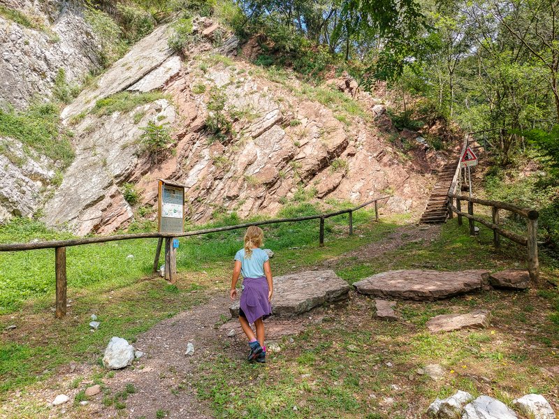
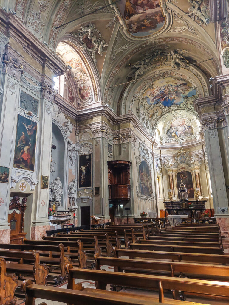
When you get off at the station, follow the signs to the center of the village. Behind the Chiesa Collegiata di S. Vittore (see photo), the descent to the river begins.
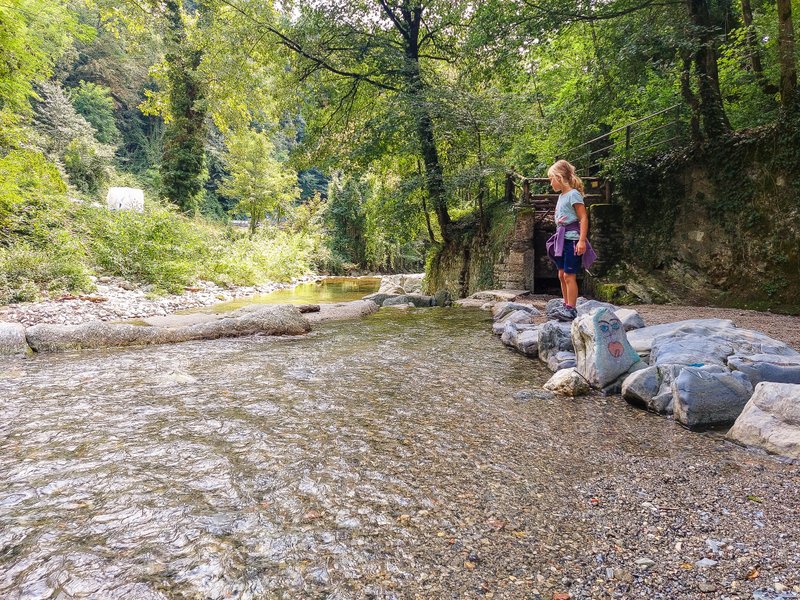
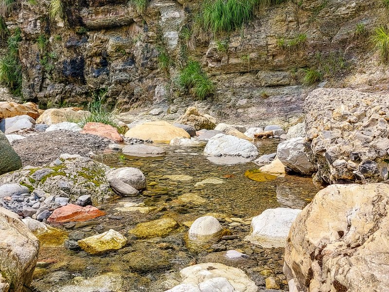
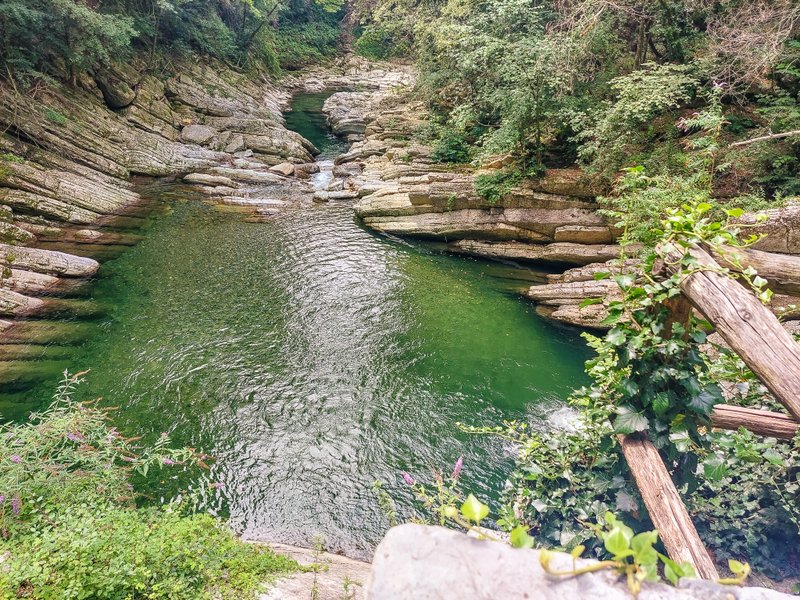
You will walk along the river, from where you can observe interesting rock formations. Small grassy or rocky beaches tempt you to relax, but you still have the main part of the route ahead of you 🙂 .
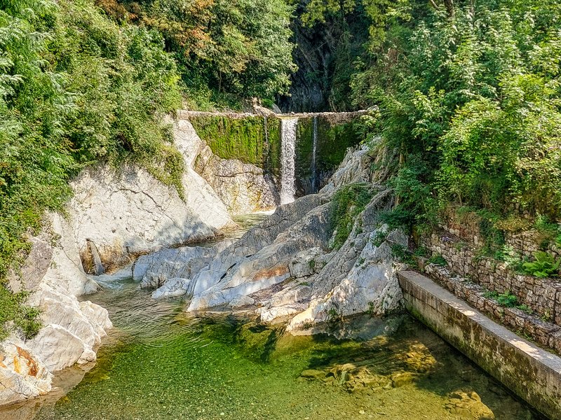
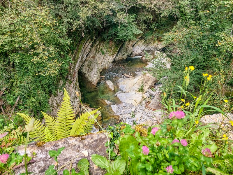
Cascata della Breggia
In about ten minutes, you will reach the abandoned Saceba cement factory. You cross a bridge from which you can see the Cascade della Breggia waterfall. We were here in the hot summer when there was little rain, so the waterfall was just a thin stream. But I believe that the mass of water must be impressive in spring or during periods of heavier rainfall.
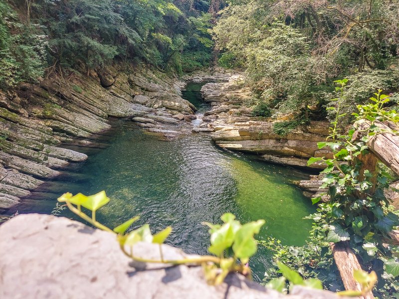
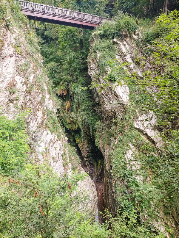
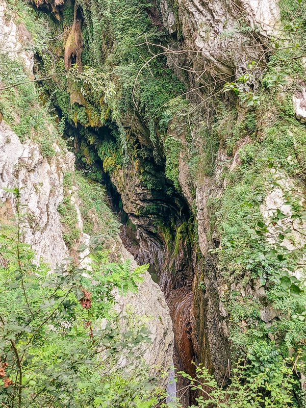
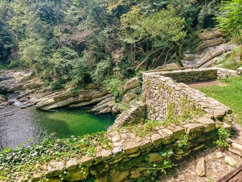
Breggia Gorge
Just after the waterfall, the climb through the gorge begins. After about half a kilometer, you will reach the Punt dal Farügin Bridge, also known as the “Ponte del Diavolo” or “Devil’s Bridge.” This junction between the two sides of the valley is the best and highest point for observing the gorges excavated by the Breggia River.
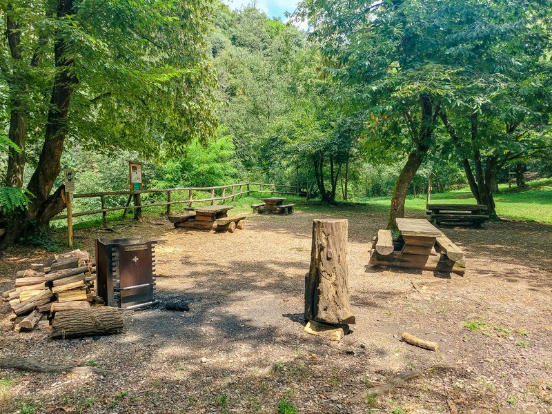
Barbecue area – Grigliata parco Breggia
You cross the bridge, and a short distance beyond is a nice barbecue area with several picnic tables.
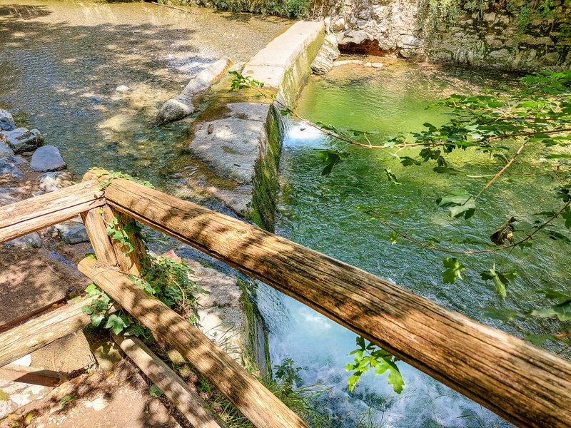
Mulin da Canaa
A few minutes from the barbecue area is a turn-off to a former mill. At its remains, you can admire the quartz limestones, which are the oldest maritime deposits in the geopark.
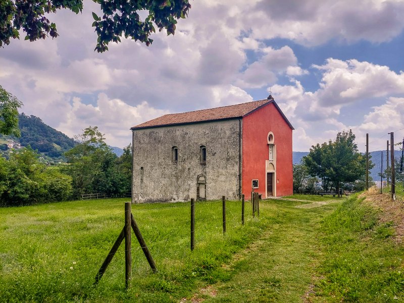
Chiesa di San Pietro – Chiesa Rossa
From the remains of the mill, you will return to the hiking trail, cross the Punt da Canaa bridge, and, after about a kilometer, reach the “Red Church.” The 14th-century church is typically closed, so if you want to admire the preserved Gothic frescoes, you must arrange an individual visit with the Cottarelli-Günther family.
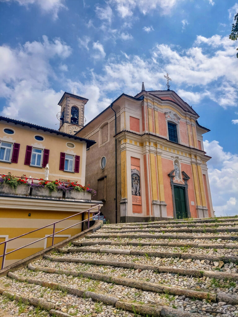
Castel San Pietro
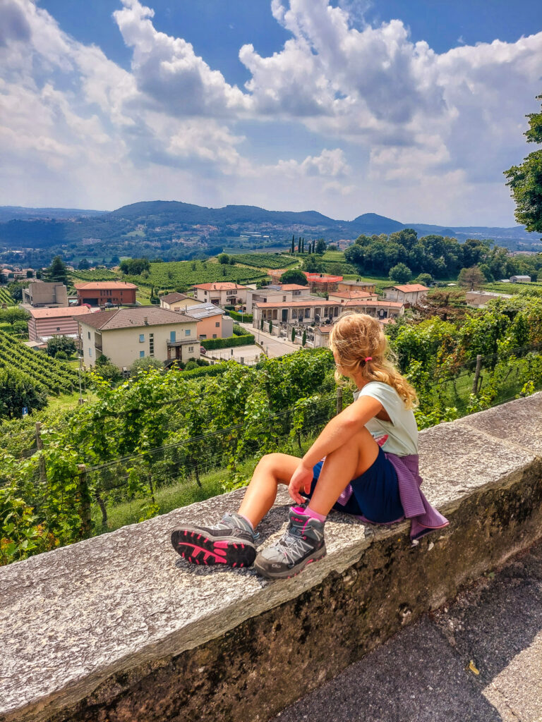
You will go from one church to the next in about ten minutes. This one is called Chiesa di Sant Eusebio and is located at the end of your route in the village of Castel San Pietro. While inside the church, you can admire the beautiful Baroque decoration. From the wall around the church, you will have fantastic views of the local vineyards. It’s just a short walk from the church to the Castel S. Pietro, Posta bus stop. Buses run once an hour.
Summary
- The park covers an area of 1 km2 in the municipalities of Balerna, Castel San Pietro, Morbio Superiore, and Morbio Inferiore.
- The park is free to visit and follows a network of marked hiking trails.
- It takes about 2.5 hours to walk the entire route.
- The park is a protected area. Collecting stones and fossils and picking and uprooting plants is strictly forbidden.
- Camping is not allowed. Fires may only be lit in designated areas.


