


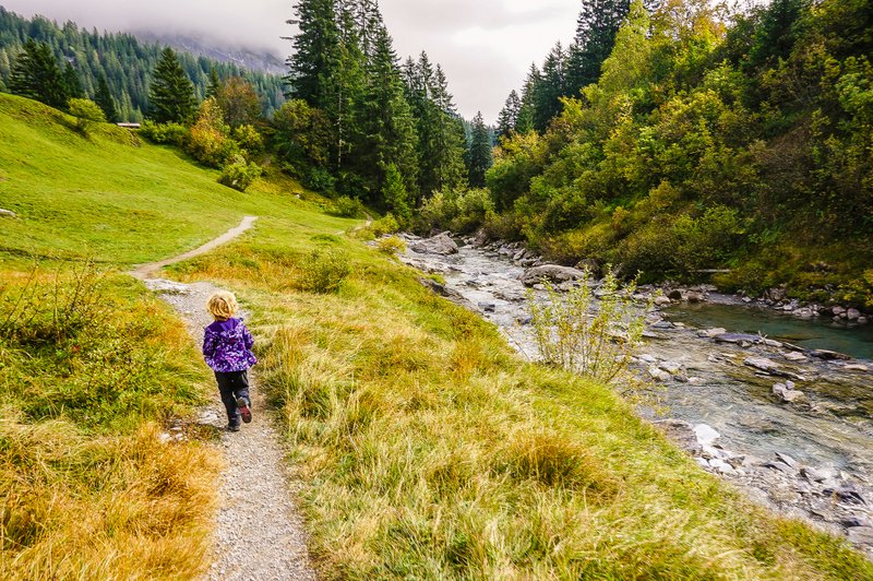
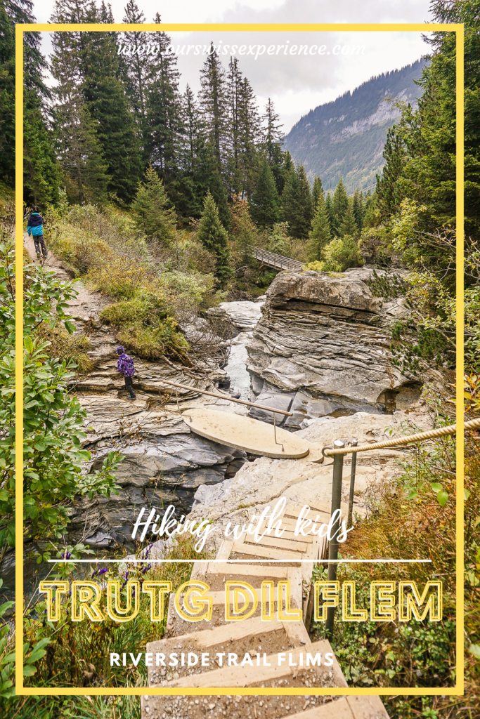
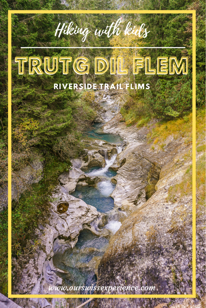
Hiking with kids: The Trutg dil Flem riverside trail
The name of the trail may seem a bit foreign to you, and maybe you are not so far from the truth. Trutg dil Flem is in fact the name in Romansh, one of the four official languages of Switzerland. This is the language spoken in the canton of Graub¨unden, where you will find this particular route, which translates as “riverside trail”. That’s because the Trutg dil Flem is a route that follows the Flem River almost from its source to the village of Flims. Along the way, you’ll cross seven bridges designed by the famous Graubünden bridge builder Jürg Conzett, bringing natural phenomena such as waterfalls and watermills almost within reach, while enjoying the sight of bizarre rock formations in the gorges.
[AD: the tickets were complimentary together with our hotel stay in rocksresort Laax]Update 9/2024
Trutg dil Flem
In the spring of 2014, the Trutg dil Flem trail was awarded the main prize of the Prix Rando 2014 by the Swiss Hiking Trails Association. This prize is considered one of the most important awards in the world of hiking in Europe. The unique mountain hiking trail along the River Flem convinced the jury thanks to its combination of art, technology and nature.*
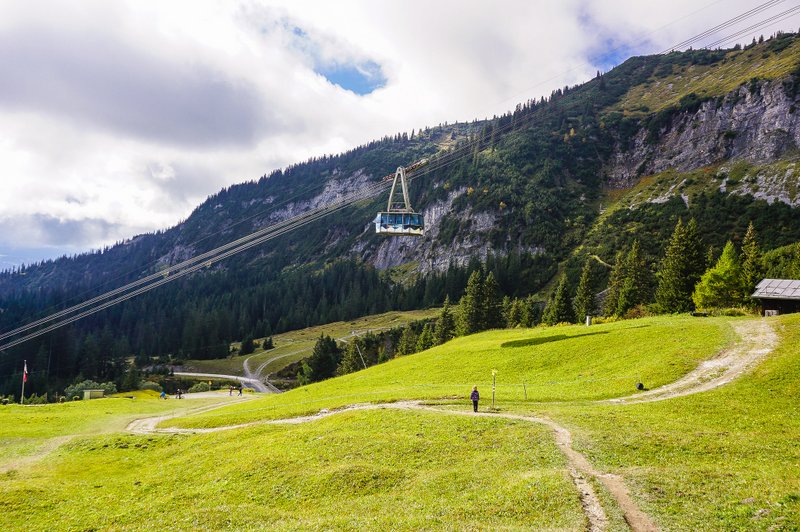
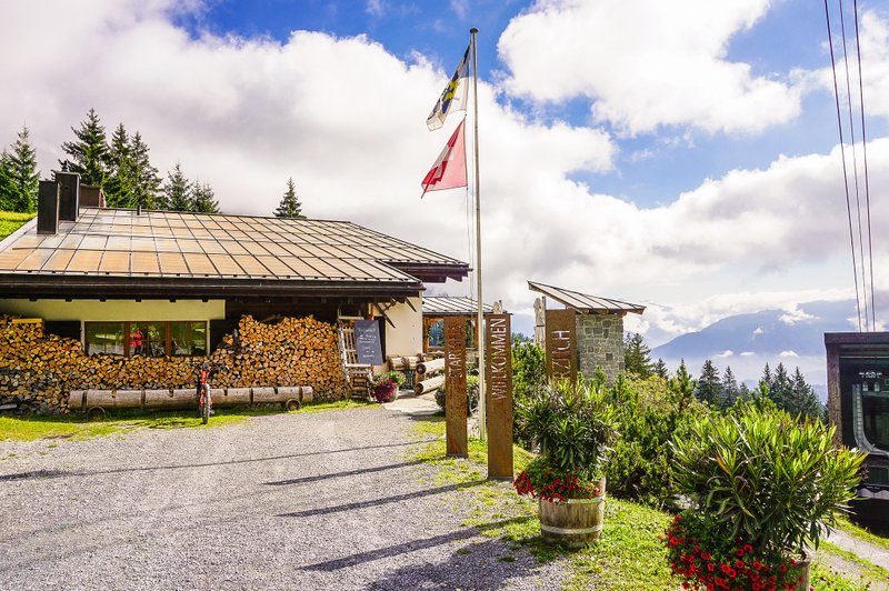
Starting point – Bergbahnen Flims
The starting point is the valley station of the new Arena Express cable car in Flims with the Nagens terminus. From rocksresort Laax, you can get here by yellow-red shuttle bus 101 (stop Flims Dorf, Bergbahnen) or by post-bus line 101.
Opening hours and prices
The operating hours of the Arena Express cable car Flims – Plaun – Nagens are from 19 July – 20 October 2024
Operating hours of the Flims-Foppa FlemXpress chairlift (Flims – Foppa – Startgels):
– 23 August to 6 October 2024. Daily operation: 7 June to 18 August 2024; 7 October to 20 October 2024. More information here.
For the Trutg dil Flem route, the daily Hiking Ticket for CHF 51 is best suited. If you have a Guest Card, you get a 5% discount.
Suggested routes of Trutg dil Flem
The total length of the Trutg dil Flem is over 14 kilometers. It is numbered 764 in the local signage. In order to make the route more accessible to less experienced hikers, you can choose from a number of options as to which way you want to go. You can find the entire route, for example, on the Schweizmobil website here.
| Route | Distanz | Zeit |
|---|---|---|
| Alp Nagens Stalla – Segneshütte – Flims Talstation | 10.4 km | 4:15 h |
| Scansinas – Panoramaweg – Flims Talstation | 11.3 km | 4:30 h |
| Flims Talstation – Punt Gronda – Flims Talstation | 3.8 km | 1:40 h |
| Flims Talstation – Punt da Max – Flims Talstation | 7.1 km | 3:05 h |
| Nagens Bergstation – Segneshütte – Foppa – Flims Talstation | 14.3 km | 4 h |
| Flims – Segnesboden – Grauberg – Runcahöhe – Flims | 22.2 km | 9:35 h |
| *source |
Formerly: route from Naraus station
In 2021, a chairlift to the Naraus station was still in operation, so we took the route from there. I’ll leave it here for comparison even though in 2024 we started in Nagens.
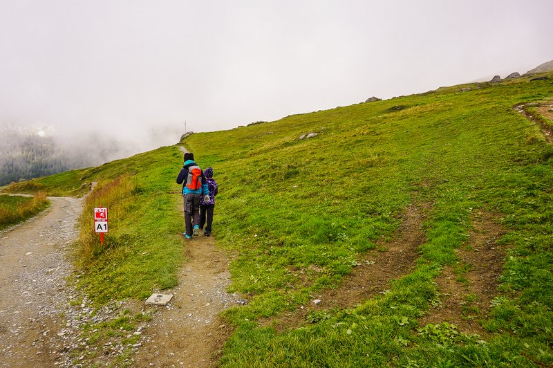
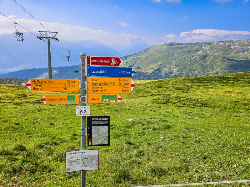
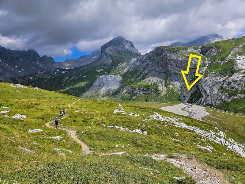
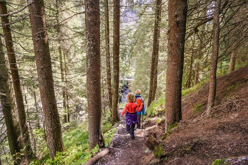
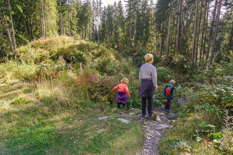
Nagens
The new Arena Express cable car took us to Nagens station. From there, we headed in the direction of the signpost. This time, we were lucky to finally glimpse the Sardona tectonic area, a UNESCO World Heritage Site.

Turn off to the waterfall
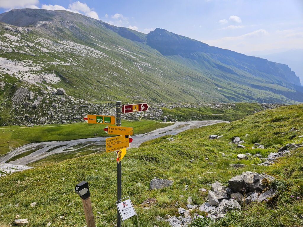
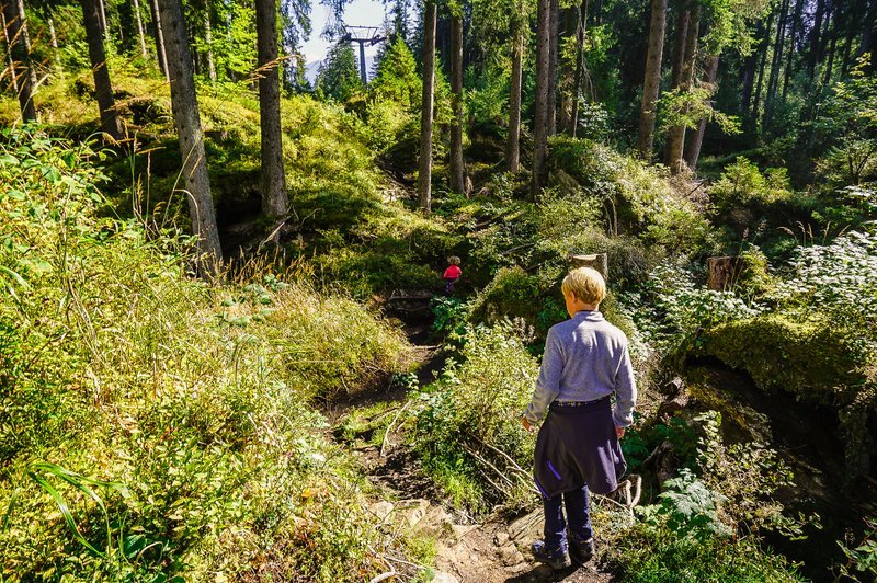
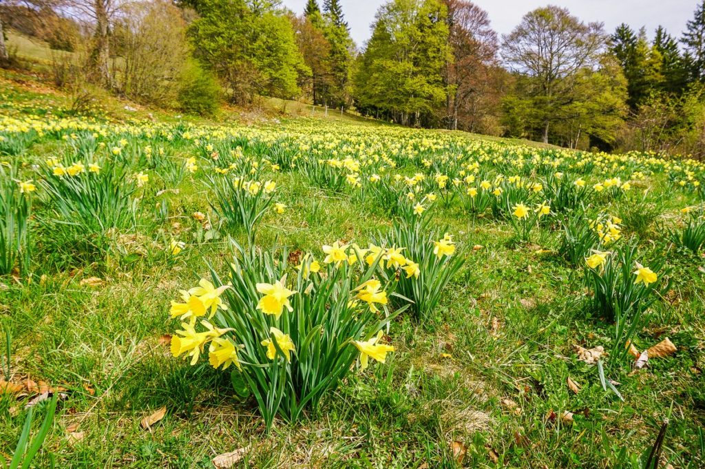
After less than two kilometers, you can turn left and go down to Plaun Segnas Sut (Segnesboden), the basin where the mountain springs meet to form the River Flem. As part of the Sardona Geopark, extraordinary flora and fauna live here. One of the mountain springs forms the Segnas waterfall. But we headed in the direction of Segneshütte.
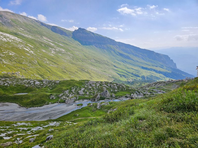
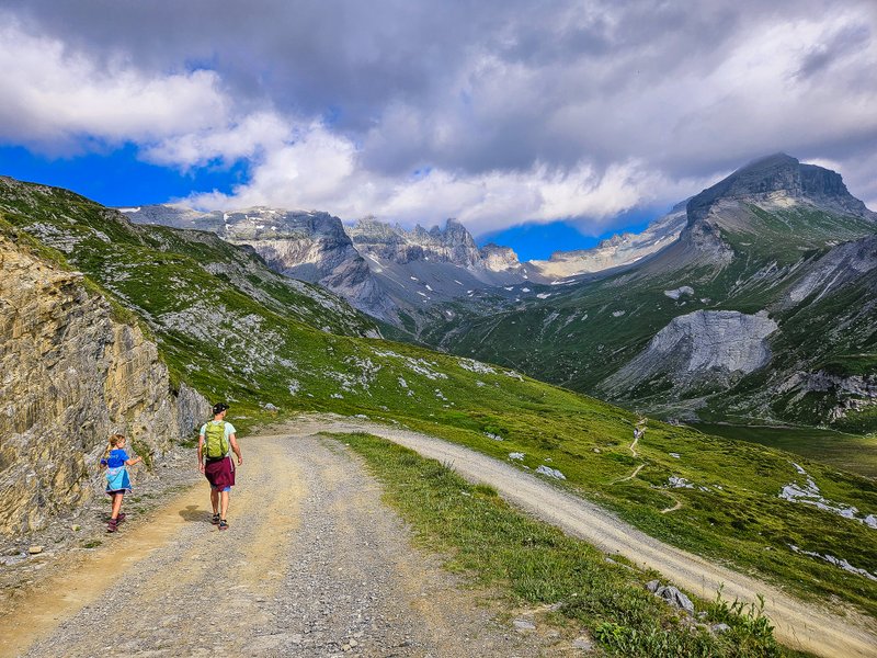
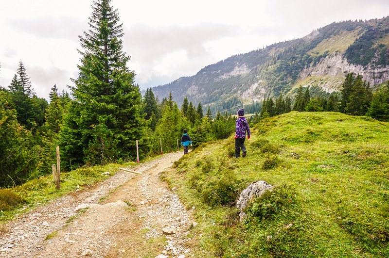
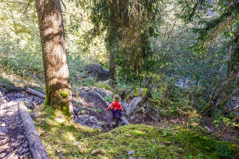
From Segneshütte, we had a few hundred meters of relatively steep descent but with great views.


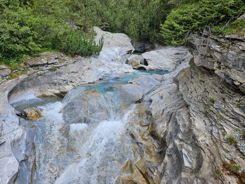
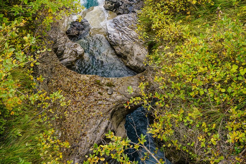
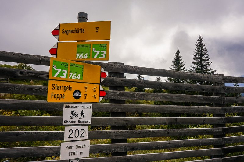
Punt Desch
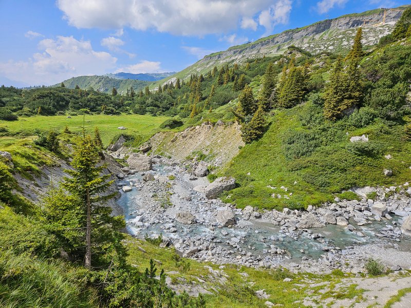
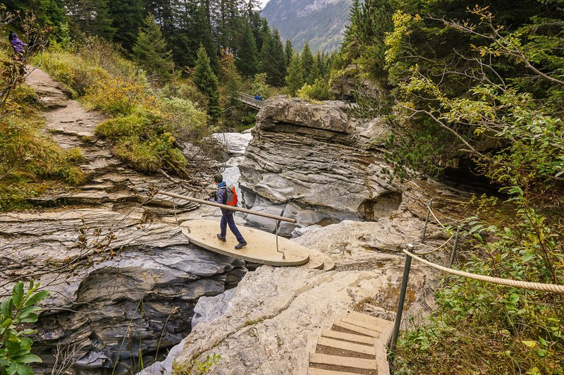
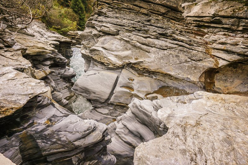
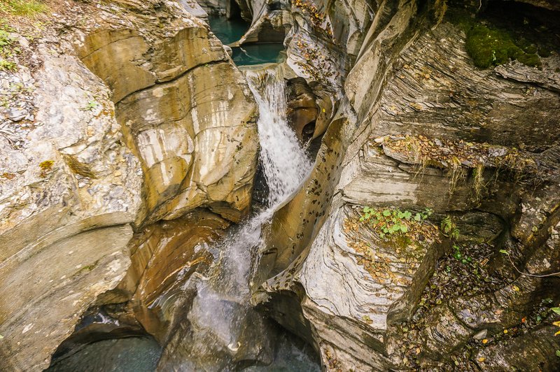
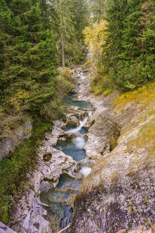
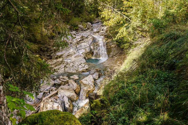
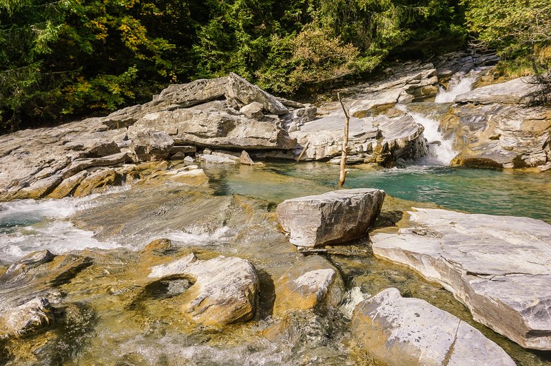
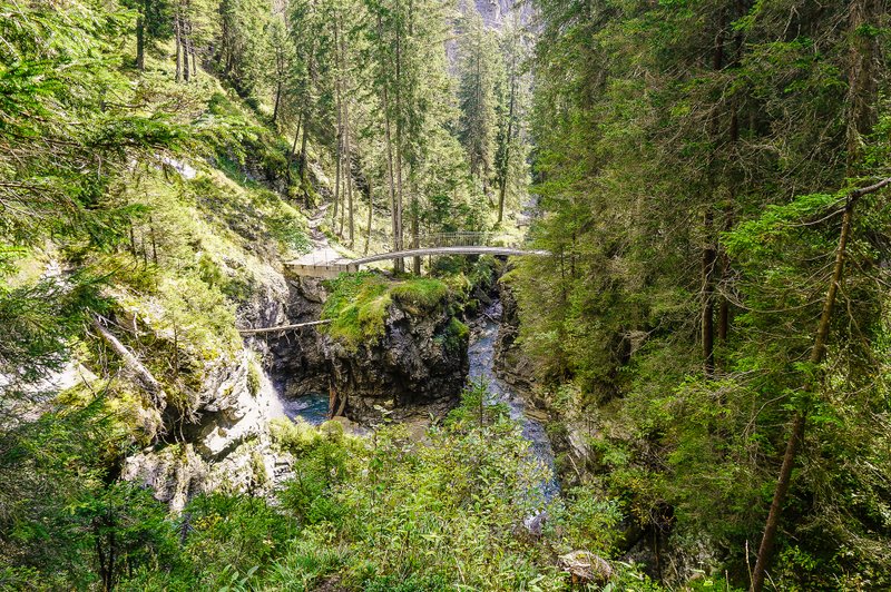
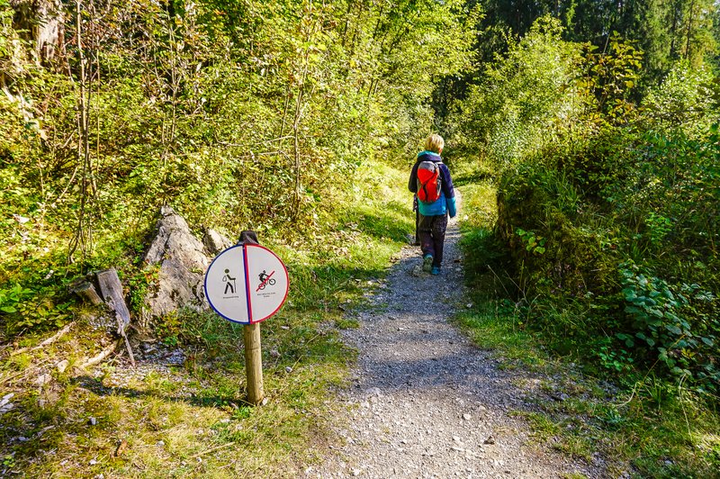
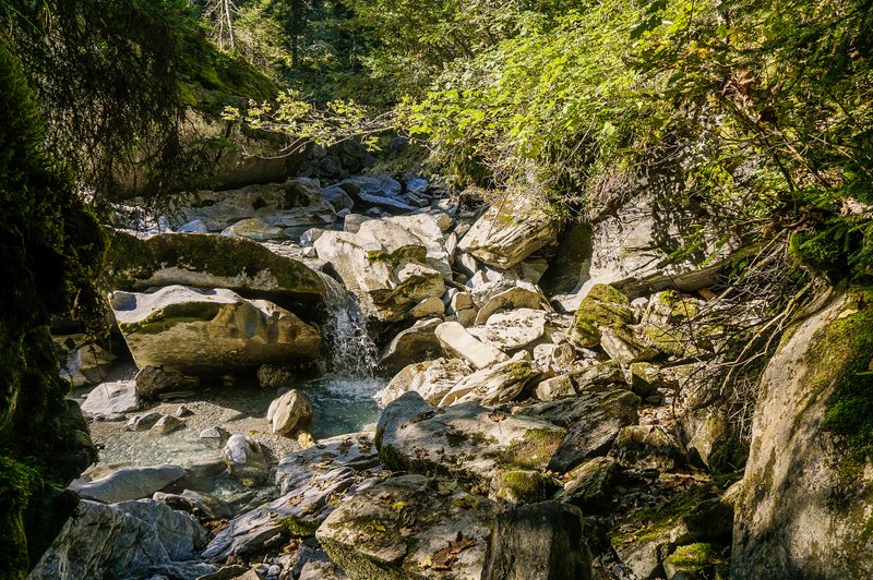
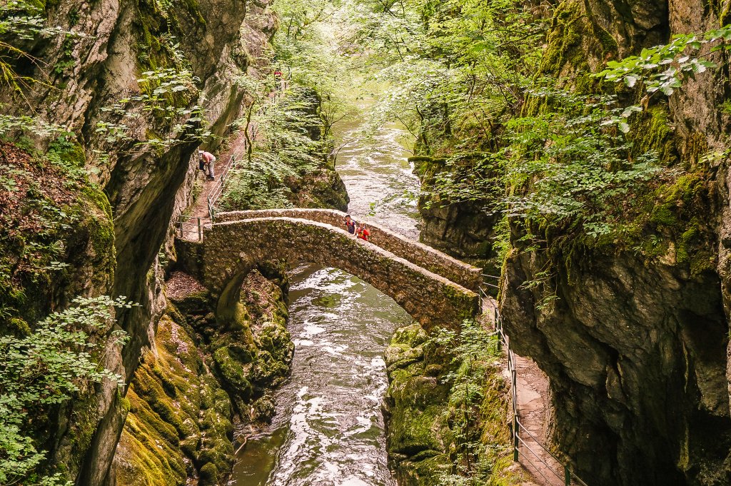
Probably the most impressive place on the route is Punt Desch, where you can watch the beautifully clear water making its way through the rock gorge. It is also at this point that the hiking trail crosses the one for bikers, so be careful and respect each other, as the writings on the signpost claim. Fortunately, the bicycle route goes a different way from the Trutg dil Flem route.
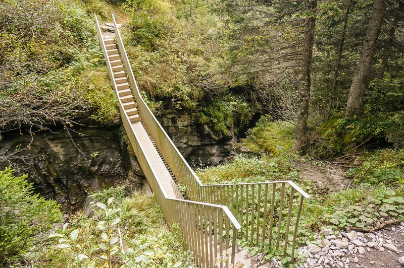
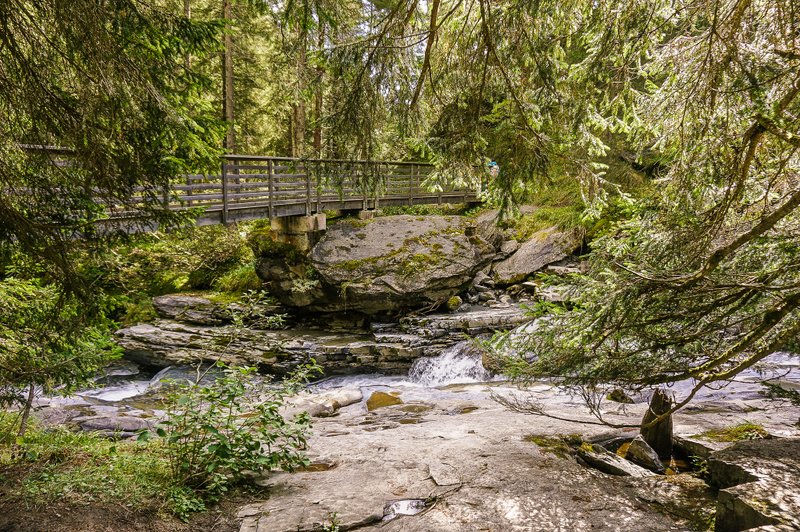
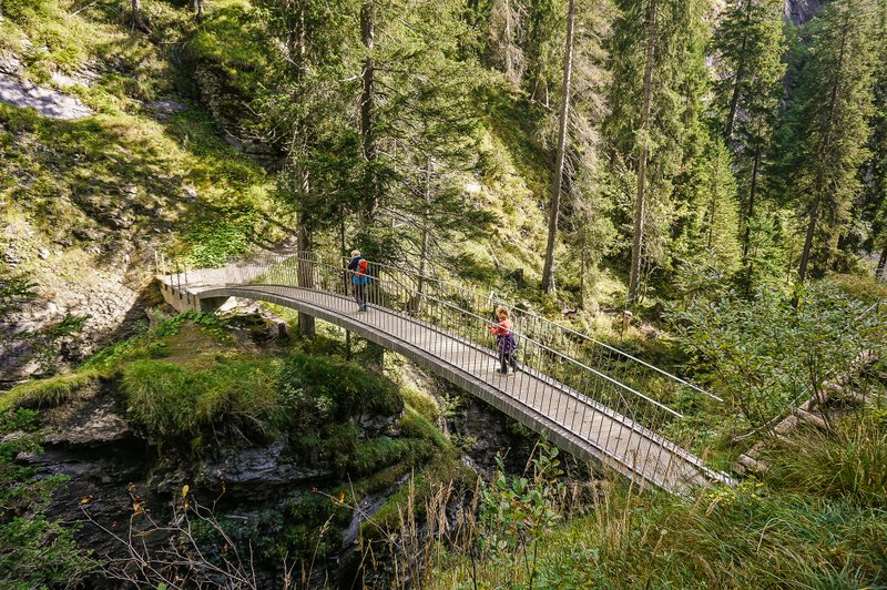
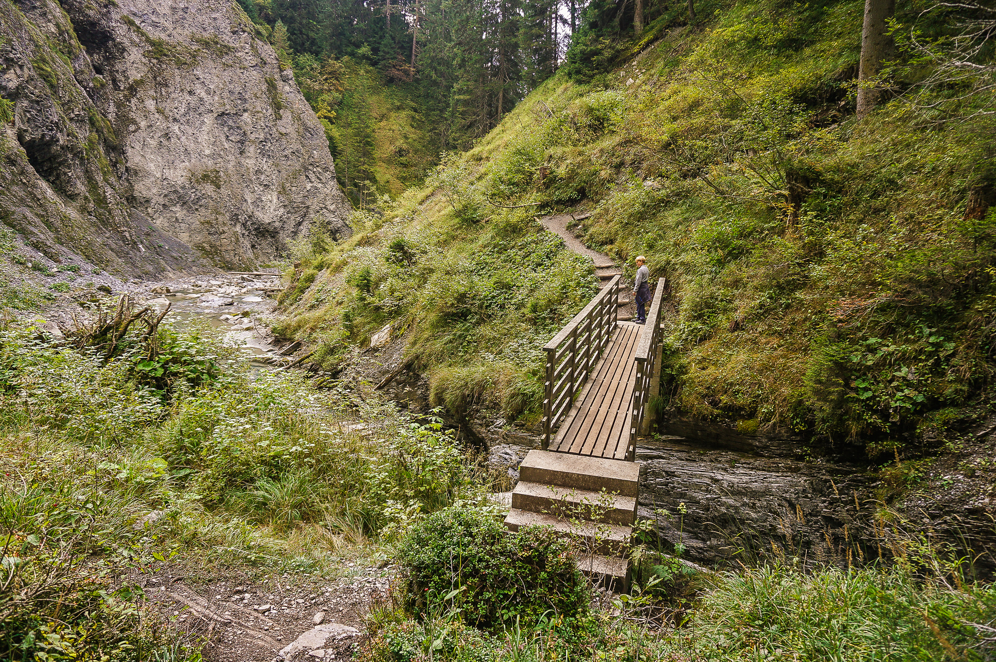
Oberste Brücke & Verweilbrücke
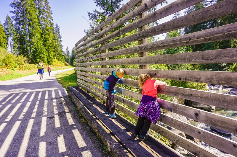
Soon we came to the first bridge “Oberste Brücke” (quite logically it is called the upper bridge 🙂 ). Just behind it, you can see the second of the bridges – Verweilbrücke. When the water level is high, you can’t cross the Oberste Brücke and you have to walk along the bank in the direction of the arrows.
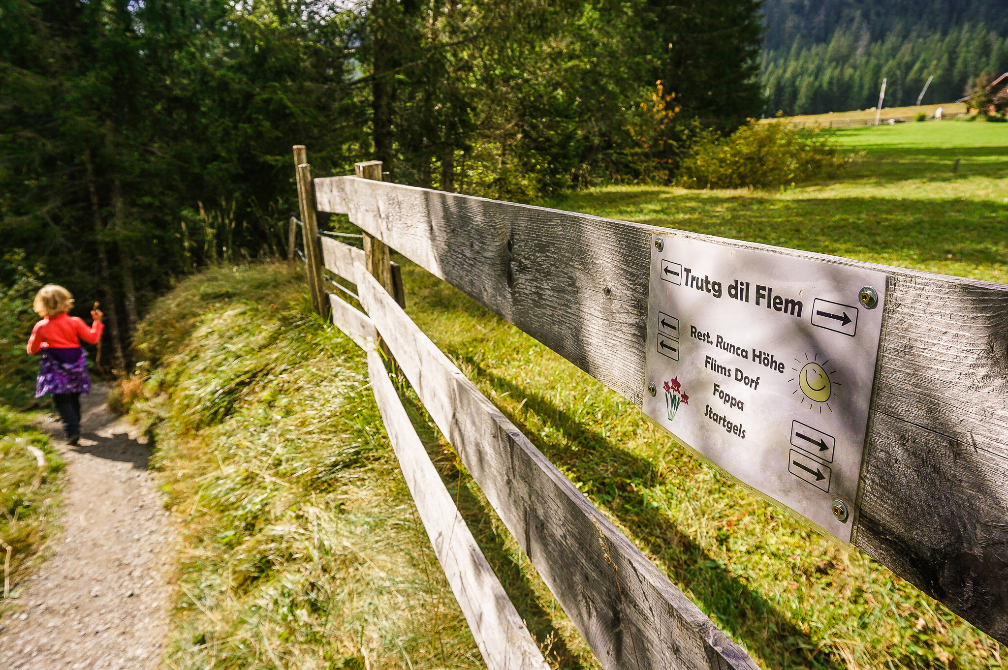
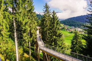
Brücke Pilzfelsen & Startgels Restaurant
After less than another kilometer, when you cross another bridge – the narrow concrete Pilzfelsen Bridge – you reach the Startgels cable car station. There is also a mountain restaurant of the same name, which offers regional specialties.
Brücke Tarschlims
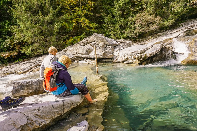
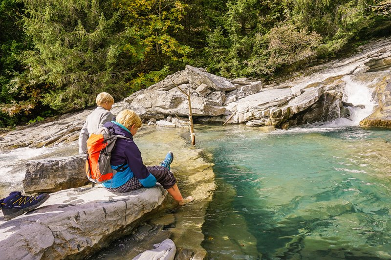
You can get a view like the one in the photo below when you stand on the Tarschlims wooden bridge.
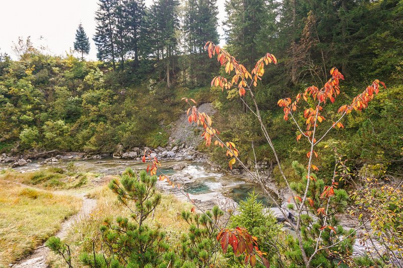
After crossing the bridge, the descent is not so steep and the river has a fairly calm flow in a wide bed. It was here that we could experience how warm (or rather cold to icy) such a mountain river is. Some brave members of our family put their feet in it as an experiment. Well, in mid-October it’s not really the best idea, but in summer this place is perfect for refreshment.
Punt da Max
The last three bridges are relatively close together. After you cross the straight Punt da Max…
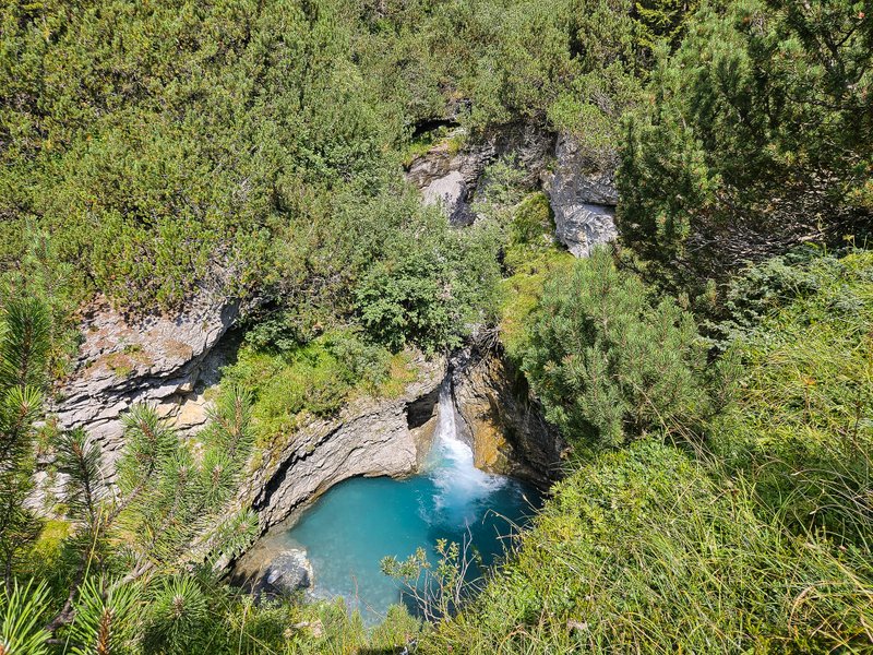
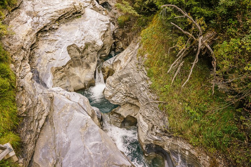
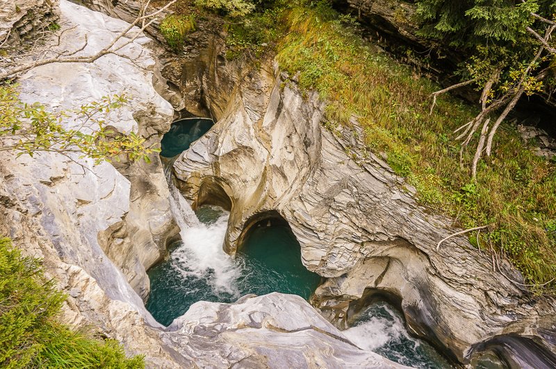
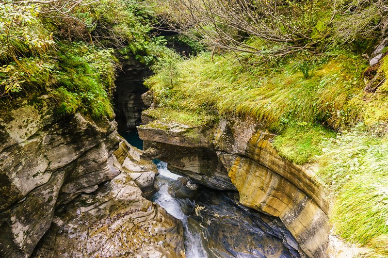
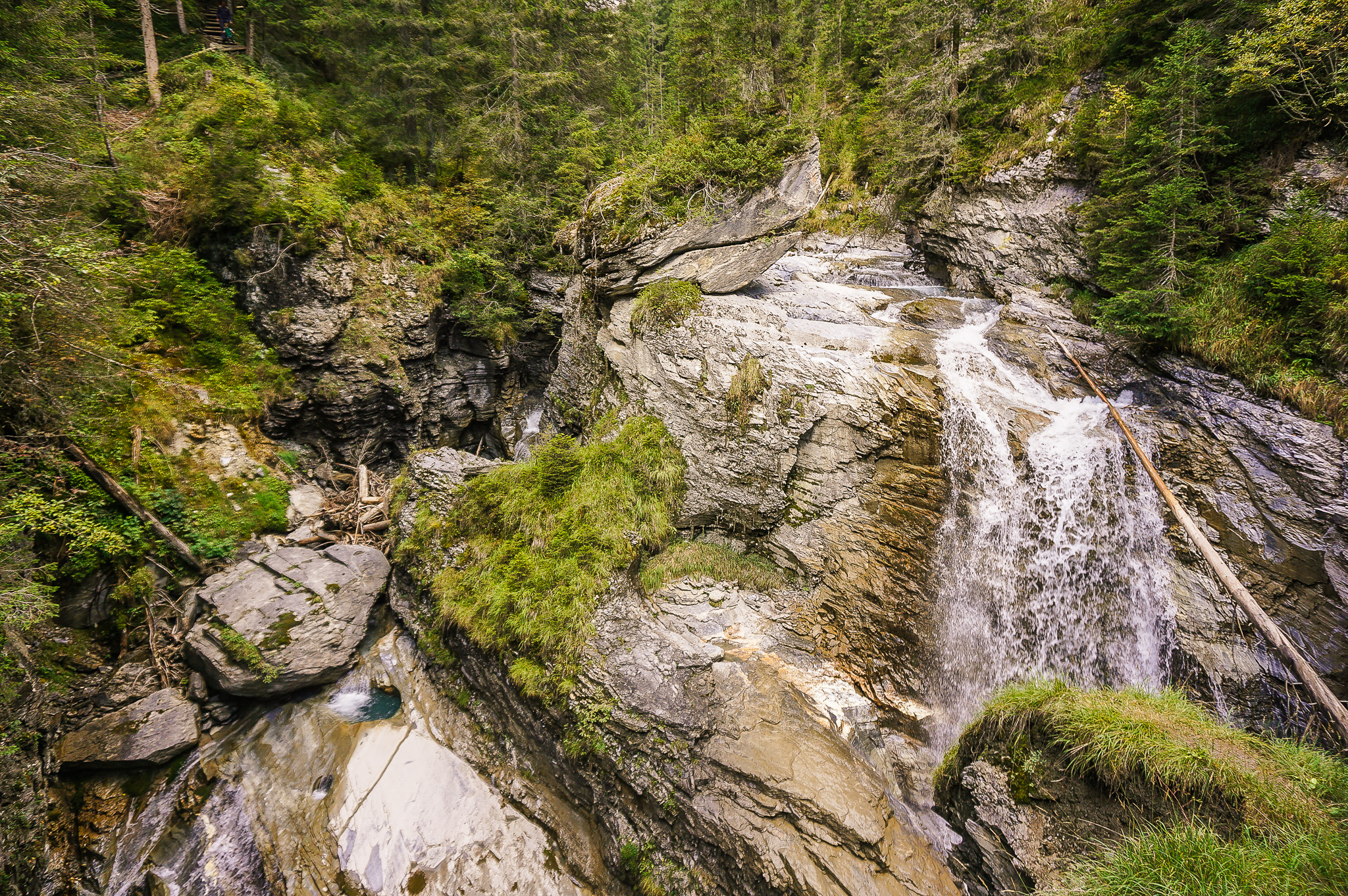
Wasserfallbrücke
…you will descend to the Wasserfallbrücke. As its name suggests, you can enjoy the view of the natural waterfalls that the river Flem creates here.
Brücke Muletg
A short distance behind the “Waterfall” bridge is the Muletg Bridge. After crossing it, you will have to zigzag up the gorge.
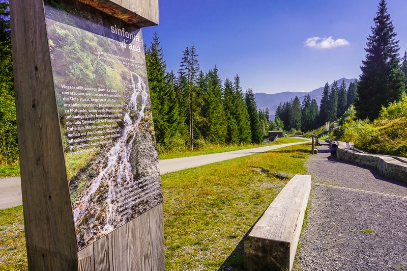
Punt Gronda – Sinfonia d’aua
Along the forest, you will reach Punt Gronda. Here, you will find the Sinfonia d’aua – not only a hydroelectric power station (note for technical enthusiasts: the building incorporates a state-of-the-art water supply system with two 600 m3 drinking water tanks and three turbines for CO2-free energy production) but also a kind of nature trail where information panels tell you, for example, where the drinking water in Flims comes from or the connection between snowmaking and the production of energy from environmentally friendly hydroelectric power.
Children will be impressed by the 25-meter-long fountain, while adults can relax, sit down or prepare a nice meal at the local “Grillstelle” (wood and grills are available).

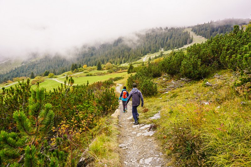
There is another signpost a short distance from the bridge in the picture above. Trutg dil Flem turns right into the forest. It’s absolutely magical, I have to tell you. Every now and then I thought a wood elf would pop out of somewhere in the lush green thicket 🙂 On the other hand, here comes another steeper descent and you have to be very careful when crossing roots and rocks.
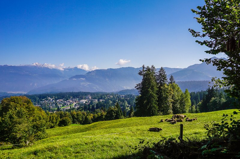
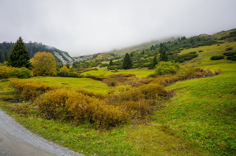
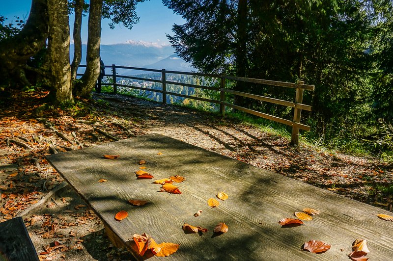
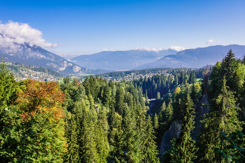
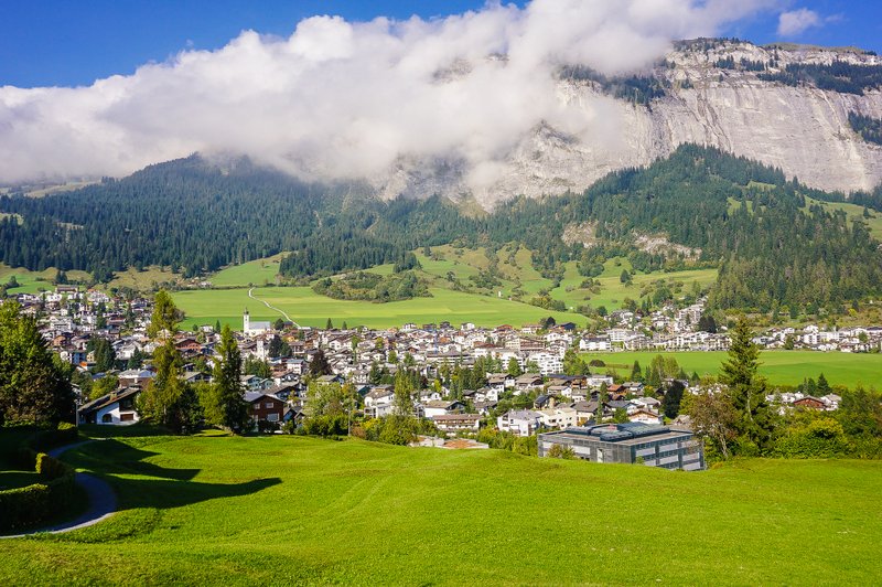
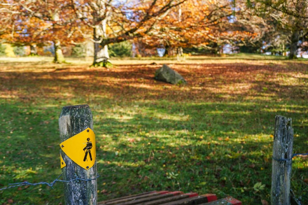
A pleasant surprise was the viewpoint where we could enjoy the view of Flims and its surroundings in autumn colors.
Summary
- The Trugt dil Flem trail is only open in the summer season and is not suitable for strollers.
- I recommend it for more experienced small hikers (the trail has a difficulty rating of T3).
- In wet conditions, there can be a risk of slipping on stones, so good hiking shoes with firm soles are recommended.
Categories: hiking


I am a member of


Map of activites

Podcast
You may be also interested in
Social Media
Categories
Subscribe