


Sion: Hike Through Vineyards Along the Historic Suonen
Do you know where the phrase “going out for wine with a friend” takes on a whole new meaning? In the canton of Valais! In our case, “going out for wine” did not mean sitting in a bar, but setting off on a hike to the famous vineyards, which are irrigated by the typical water channels known as suonen or bisse. Everything around us was bustling with activity – work in the vineyards was in full swing on that sunny September day. And what better way to end a beautiful hike than with a glass of excellent local white wine in the historic town of Sion?
Sion – how to get there
You can easily reach Sion, the capital of the canton of Valais, by car or train. Take the A9 motorway from Lausanne or Brig, and you will find parking directly in the city. By train, there is a direct line from Geneva, Lausanne, and Brig. The journey from Lausanne, for example, takes just over an hour. We used the Tageskarte (Day Pass) again for our trip, which meant we had all our transport for the day for CHF 55. And it paid off. The Day Pass is also valid on PostAuto lines, i.e., the yellow buses we needed to take to the starting point of our hike. The bus station is located right in front of the train station, so you can’t miss it.
We needed to get to the Savièse, Drône centre stop, so we took the 341 bus. The ride took 30 minutes.

Savièse, Drône
After a rather adventurous bus ride (you wouldn’t believe how narrow the streets are!), we got off in the village of Drône. We knew we were in the right place (because we were the only ones who got off there and there was no one else in sight) thanks to a sign at the crossroads showing the route we planned to take. Although it was only in French, we used modern technology to read the quiz question: What interesting plant will you encounter along the route? A cactus, pineapple, or avocado? If you want to know the correct answer, read on!


Bisse de Lentine
We descended a gentle hill, turned left, and found ourselves in the heart of the vineyards above Sion. A layman would say that our path led along a stream. But these “streams” are called suonen (bisse in French) and are an ancient system of water channels located in the canton of Valais in Switzerland. Suonen were built using various techniques and materials and are part of the unique engineering heritage of this region. They were built to bring water from mountain streams and glacial pools to the valley and to cultivated land, especially to wine-growing and agricultural areas.


Suonen are often supported by stone walls (or metal troughs, as shown in the photo) or carved into the rock, which adds a special visual charm to their construction. In the past, strict agreements were made about who was allowed to take or divert how much water, and these were strictly enforced. Diverting water from the Suonen is still expressly prohibited today.


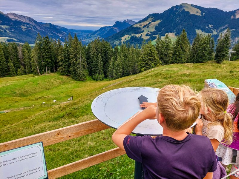
Grand Tour of Switzerland photo frame
About halfway through the route, we came to a signpost. And here I have to confess something! The moment I saw the Grand Tour of Switzerland photo frame, that was all I could think about, and because of my blindness, we completely missed Lac du Mont d’Orge. Oh well, next time. But at least I have another photo spot to add to my collection. Want to see my other finds? Check out this article.

Bisse de Mont d’Orge
We then continued along another irrigation canal, Bisse de Mont d’Orge. And here we finally came across the plant mentioned at the beginning of this article. The correct answer is: a cactus! Yes, this area has an almost Mediterranean climate, so plants like this are not uncommon here. You can learn not only about the local climate, but also about the local wine and two castles from the information signs along the route. They are in French and German.


Sion
Our route led directly to the Pont-de-la-Morge, centre bus stop. The ride back to the center of Sion took only a few minutes. As I mentioned earlier, Sion is the capital of the canton of Valais. It has an exceptionally long history—archaeological evidence indicates that people have lived here since the Neolithic period. The city center is filled with historic buildings, and we were fortunate to be there during the markets. We had an excellent lunch (and, of course, a glass of local wine!) at Brasserie du Grand Pont.


Tourbillon Castle
The apparent reason for the construction of the ancient settlement was undoubtedly the pair of rocky hills on which two medieval castles stand, visible from afar. Of the two fortresses, the better preserved is the Château de Valère (actually a castle and basilica in one), which apparently stands on the remains of a Roman temple. The most interesting feature is the oldest still-playing organ in the world, dating back to 1390. Château de Tourbillon was built in 1294. It was destroyed in 1788 and has not been restored. Today, the ruins are accessible free of charge, and guided tours are also offered here daily at 11 a.m., 12 p.m., 3:30 p.m., and 4:30 p.m. I definitely recommend climbing up to at least one of the castles, as they offer spectacular views of the city and the valley.


Summary
- The route is 8.8 km long and is not suitable for strollers.
- The starting bus stop is Savièse, Drône centre, and the stop at the end of the route is Pont-de-la-Morge, centre.
Categories: hiking


I am a member of


Map of activites

Podcast
You may be also interested in
Social Media
Categories
Subscribe